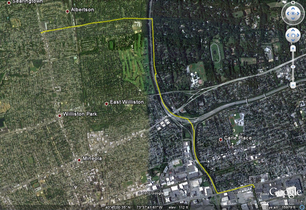

Ever wanted to plot your path on a roadtrip or walk through the woods?
Wanted to see where your robots went while you were asleep?
We just made it super easy . . .
Using RobotC, you can download this program, drag it all over the earth, and then snap! open the file in Google Earth and see where you went. In five easy steps.
- Upload our program. (Can you do better? Send us something!)
- Attach the dGPS, get a signal.
- Start the program and proceed to wander.
- Stop roaming. Download the file “Path.txt” to your desktop.
- Rename the file to “Path.kml”. Double click the file. Voila.
We made a quick video below.
Later in the week, we’ll release the NXT-G drivers for those of you who don’t use RobotC.
You can:
- See other posts on the dGPS GPS sensor for Lego Mindstorms NXT.
- Buy a dGPS GPS sensor for Lego Mindstorms NXT.
2 Comments
-
Hi Guys
may I check with you, that with a dGPS sensor, I can ask Lego Mindstorms run from a drawing curve, or from a point to another point on a Goodle MAP? How to do this so? Thanks for your help
Cheers
Tai-
Hey Tai,
I think what you’re asking is whether the dGPS sensor calculates distance over a straight line or over the surface of a sphere?
The dGPS uses the Haversine formula to calculate the distance over an assumed sphere (slightly oblong sphere). For example, if you calculate the distance from one side of the earth to the other, it will be the distance over the surface of the earth, not straight through.
-
Leave a reply
You must be logged in to post a comment.